|
|

|
Space History for May 4
If you are not already a subscriber, you are welcome to enter your email address here to sign up to receive the Space History newsletter on a daily basis. Under no circumstances will we release your legitimate email address entered here to outside persons or organizations, and it will only be used for mailing the specific information you have requested.
| Enter your email address here: |
Unsubscribe instructions are included in every newsletter issue in case you decide you no longer wish to receive it.
Note: We record the IP address from which subscriptions are entered to help prevent SPAM abuses.
Race To Space
Someone will win the prize...
... but at what cost?
Visit RaceToSpaceProject.com
to find out more!
1626
Dutch explorer Peter Minuit landed on present-day Manhattan Island, and purchased Manhattan from the resident Lenape native tribe for the equivalent of $24 in cloth, beads and baubles.
ref: en.wikipedia.org
1886
R. Luther discovered asteroid #258 Tyche.
1896
A. Charlois discovered asteroid #416 Vaticana.
1926
Born, Milton Orville "Milt" Thompson (at Crookston, Minnesota, USA), astronaut candidate (USAF Dynasoar Group - 1960), NASA test pilot (X-15), Director of Research Projects at Dryden Research Center (1966) (deceased)
ref: en.wikipedia.org
1927
The first balloon flight to an altitude over 40,000 feet was made by US Air Corps Capt. Hawthorne C. Gray from Scott Field, Illinois, achieving a world record height of 42,740 feet (13,027 meters, 8.09 miles).
ref: www.nationalmuseum.af.mil
1956
Born, Michael L. Gernhardt PhD (at Mansfield, Ohio, USA), NASA astronaut (STS 69, STS 83, STS 94, STS 104; nearly 43d 7h total time in spaceflight)
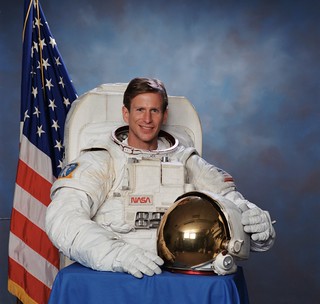
Astronaut Michael Gernhardt, STS-104 mission specialist, NASA photo, July 2001
ref: en.wikipedia.org
1958
Born, Maurizio Cheli (at Modena, Italy), Lt. Colonel Italian AF, ESA astronaut (STS 75; nearly 15d 17.75h in spaceflight), married to ESA astronaut Marianne Merchez
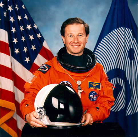
ESA astronaut Maurizio Cheli, NASA photo
Source: Wikipedia (www.jsc.nasa.gov unavailable from May 2019)
ref: www.esa.int
1961
Malcolm Ross and Victor Prather reached a record altitude of 113,740 feet (34.668 km, 21.5 miles) in the Strato-Lab V balloon. The absolute altitude record for balloonists returning to Earth with the balloon has not been broken as of 2022.
ref: en.wikipedia.org
1967
The last data was received from NASA's Surveyor 3 spacecraft on the Moon.
Surveyor 3, launched 17 April 1967, was the second spacecraft in the Surveyor series to acheive a soft landing on the Lunar surface. The main purpose of the mission was to determine various characteristics of the Lunar terrain in preparation for Apollo Lunar landing missions. Equipment on board included a television camera and auxiliary mirrors, a soil mechanics surface sampler, strain gages on the spacecraft landing legs, and numerous engineering sensors. The spacecraft landed on the Moon at 3.01 deg S latitude, 23.42 deg W longitude in the southeastern part of Oceanus Procellarum at 00:04:53 UT on 20 April 1967 (19 April 19:04:53 EST). Touchdown on the Lunar surface occurred three times because the Vernier engines continued to fire during the first two touchdowns causing the spacecraft to lift off the surface. A large volume of new data on the strength, texture, and structure of Lunar material was transmitted by the spacecraft, in addition to the Lunar photography transmission. The last data were returned on 4 May 1967.
On 19 November 1969, the Apollo 12 Lunar Module (LM) landed within about 180 meters of the Surveyor 3 spacecraft. Astronauts Pete Conrad and Alan Bean visited the earlier spacecraft on their second moonwalk on 20 November, examining Surveyor 3 and its surroundings, taking photographs, and removing about 10 kg of parts from the spacecraft, including the TV camera, for later examination back on Earth.
The Surveyor 3 camera is now on display in the Smithsonian National Air and Space Museum in Washington, D.C.
ref: nssdc.gsfc.nasa.gov
1967 22:25:00 GMT
NASA launched Lunar Orbiter 4, a Moon mapping orbiter, to perform a broad systematic photographic survey of Lunar surface features .
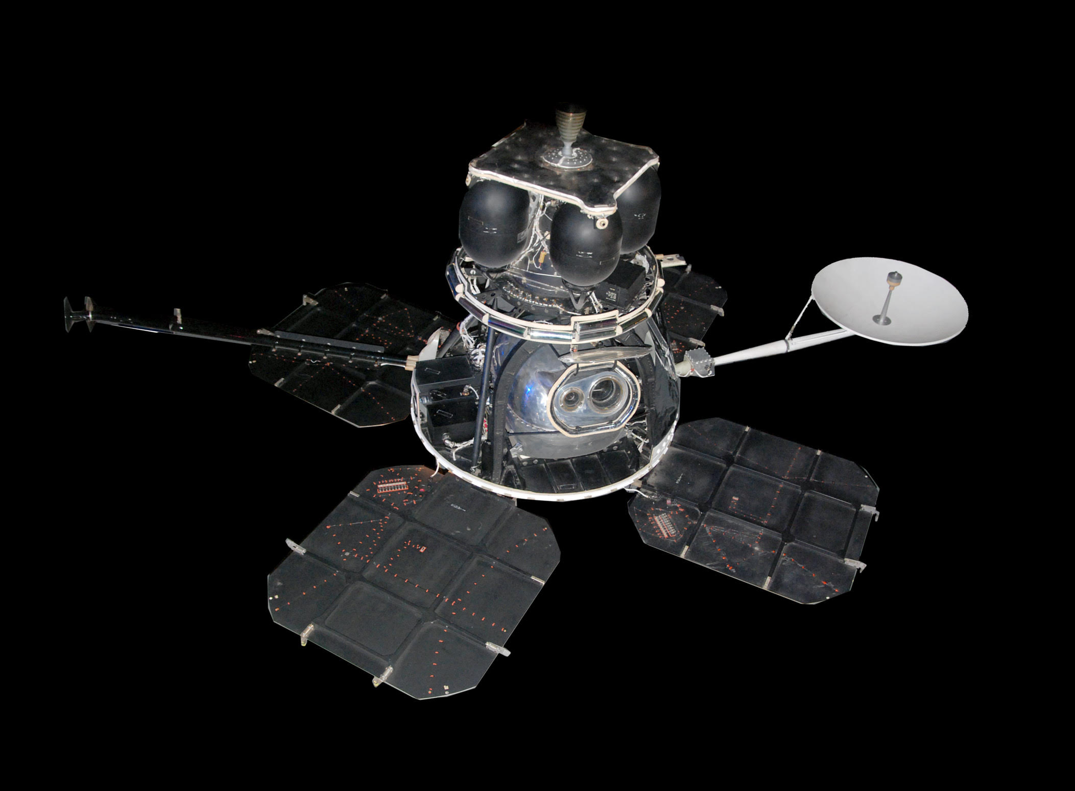
Lunar Orbiter 4, NASA photo
Source: NSSDCA Master Catalog
Lunar Orbiter 4, launched 4 May 1967, was designed to take advantage of the fact the three previous Lunar Orbiters had completed the required needs for Apollo mapping and site selection. It was given a more general objective, to "perform a broad systematic photographic survey of Lunar surface features in order to increase the scientific knowledge of their nature, origin, and processes, and to serve as a basis for selecting sites for more detailed scientific study by subsequent orbital and landing missions." It was also equipped to collect selenodetic, radiation intensity, and micrometeoroid impact data. The spacecraft was placed in a cislunar trajectory and injected into an elliptical near polar high Lunar orbit on 7 May 1967 for data acquisition. The orbit was 2706 km x 6111 km with an inclination of 85.5 degrees and a period of 12 hours.
After initial photography on 11 May 1967, problems started occurring with the camera's thermal door, which was not responding well to commands to open and close. Fear that the door could become stuck in the closed position, covering the camera lenses, led to a decision to leave the door open. This required extra attitude control manuevers on each orbit to prevent light leakage into the camera which would ruin the film. On 13 May it was discovered that light leakage was damaging some of the film, and the door was tested and partially closed. Some fogging of the lens was then suspected due to condensation resulting from the lower temperatures. Changes in the spacecraft's attitude raised the temperature of the camera and generally eliminated the fogging. Continuing problems with the readout drive mechanism starting and stopping beginning on 20 May resulted in a decision to terminate the photographic portion of the mission on 26 May. Despite problems with the readout drive, the entire film was read and transmitted. The spacecraft acquired photographic data from 11 May to 26 May 1967, and readout occurred through 1 June 1967. The orbit was then lowered to gather orbital data for the upcoming Lunar Orbiter 5 mission.
A total of 419 high resolution and 127 medium resolution frames were acquired covering 99% of the Moon's near side at resolutions from 58 meters to 134 meters. Accurate data were acquired from all other experiments throughout the mission. Radiation data showed increased dosages due to solar particle events producing low energy protons. The spacecraft was used for tracking purposes until it impacted the Lunar surface due to the natural decay of the orbit on 31 October 1967, between 22 and 30 degrees W longitude.
Results of the Lunar Orbiter Program
NASA's Lunar Orbiter program consisted of 5 Lunar Orbiters which returned photographs of 99% of the surface of the Moon (both the near and far sides) with resolution down to 1 meter. Altogether the Orbiters returned 2180 high resolution and 882 medium resolution frames. The micrometeoroid experiments recorded 22 impacts showing the average micrometeoroid flux near the Moon was about two orders of magnitude greater than in interplanetary space but slightly less than the near Earth environment. The radiation experiments confirmed that the design of the Apollo hardware would protect the astronauts from average and greater-than-average short term exposure to solar particle events. The use of the Lunar Orbiters for tracking to evaluate the Manned Space Flight Network tracking stations and Apollo Orbit Determination Program was successful, with three Lunar Orbiters (2, 3, and 5) being tracked simultaneously from August to October 1967. The Lunar Orbiters were all eventually commanded to crash on the Moon before their attitude control gas ran out so they would not present navigational or communications hazards to the later Apollo flights.
See also Wikipedia, Lunar Orbiter 4
ref: nssdc.gsfc.nasa.gov
1976 08:00:00 GMT
NASA launched LAGEOS 1 to aid measuring shifts of continental land masses by reflecting laser beams off its refecting mirrors.
LAGEOS (Laser Geodetic Satellite) was a very dense (high mass-to-area ratio) laser retroreflector satellite which provided a permanent reference point in a very stable orbit for such precision Earth-dynamics measurements as crustal motions, regional strains, fault motions, polar motion and Earth-rotation variations, solid Earth tides, and other kinematic and dynamic parameters associated with earthquake assessment and alleviation. In conjunction with appropriate laser-tracking systems, LAGEOS permitted extreme precision-ranging measurements for both geometric mode (multilateration) and orbital dynamic mode determinations of positions of points on the Earth. It was the first spacecraft dedicated exclusively to high-precision laser ranging and provided the first opportunity to acquire laser-ranging data that were not degraded by errors originating in the target satellite. The high-accuracy range measurements from this permanent-orbiting reference point were used to accomplish many extreme precision Earth-dynamics measurements required by the earthquake hazard assessment and alleviation objectives of the Earth and Ocean Physics Applications Program (EOPAP). The performance in orbit of LAGEOS was limited only by degradation of the retroreflectors, so many decades of useful life can be expected. The high mass-to-area ratio and the precise, stable (attitude-independent) geometry of the spacecraft, together with the orbit, made this satellite the most precise position reference available. Because it is visible in all parts of the world and has an extended operation life in orbit, LAGEOS can serve as a fundamental standard for decades.
ref: nssdc.gsfc.nasa.gov
1979 18:55:00 GMT
NASA launched FltSatCom 2 for the US Department of Defense.
FLTSATCOM 2, launched 4 May 1979, was the heaviest communications satellite the United States had attempted to orbit, exceeding the previous leader, TACSAT-1, by over 250 lbs. The FLTSATCOM (Fleet Satellite Communications) communications satellite system served as a world-wide UHF communications link among US Navy aircraft, ships, submarines, and ground stations. The high capacity spaceborne communications system gave the Navy both shore-to-fleet and single-way communication among ships, aircraft, and submarines separated by distances exceeding line-of-sight UHF ranges. The satellite provided 30 voice channels and 12 teletypewriter channels simultaneously in UHF. A number of channels were reserved for high-priority US Air Force ground-to-air communications with Strategic Air Command aircraft, the E-3A airborne warning and control system, and elements of the Presidential command structure. Unlike most military and commercial communications satellites, the FLTSATCOM satellites used a triaxial stabilization system utilizing a reaction control wheel assembly instead of spin stabilization. Electrical power was provided by 2 three-section solar panels mounted on booms extending from the satellite body and unfolded in space. Nickel-cadmium batteries provided power during solar eclipses. The USN and USAF planned to orbit four satellites, including one as an on-station spare, positioned around the world in near-equatorial geosynchronous orbits to provide near-global coverage.
ref: nssdc.gsfc.nasa.gov
1981
T. Furuta discovered asteroid #2478 Tokai.
1984
Dave Kingman hit a fly ball that never came down. It didn't go into orbit, however - it stuck in the Metrodome's ceiling.
ref: www.mlb.com
1989 14:46:59 EDT (GMT -4:00:00)
NASA launched STS 30 (Atlantis 4, 29th Shuttle mission) carrying the Magellan/Venus Radar Mapper spacecraft to orbit, the first US planetary mission in 11 years, and the first carried into orbit on the Shuttle.
The STS 30 launch on 28 April 1989 was scrubbed at T-31 seconds due to a problem with the liquid hydrogen recirculation pump on the number one main engine and a vapor leak in a four inch liquid hydrogen recirculation line between the orbiter and the external tank. Repairs were made and the launch was reset for 4 May 1989. Liftoff was delayed until the last five minutes of the 64 minute window due to cloud cover and high winds at the Kennedy Space Center Shuttle runway, violating return-to-launch site limits.
The primary payload aboard STS 30, the Magellan/Venus radar mapper spacecraft and its attached Inertial Upper Stage (IUS), were deployed six hours, 14 minutes into the flight. The IUS first and second stage fired as planned, boosting the Magellan spacecraft on the proper trajectory for its 15 month journey to Venus. Magellan was the first US planetary science spacecraft launched in eleven years, and the first to be carried into space aboard a Shuttle.
The secondary payloads on STS 30 were: the Mesoscale Lightning Experiment (MLE), microgravity research with the Fluids Experiment Apparatus (FEA), and the Air Force Maui Optical Site (AMOS) experiment.
One of the five general purpose computers (GPC) failed and had to be replaced with a sixth onboard hardware spare. This was the first time a GPC was switched on orbit.
STS 30 ended 8 May 1989 when Atlantis landed on revolution 65 on Runway 22, Edwards Air Force Base, California. Rollout distance: 10,295 feet. Rollout time: 64 seconds. Launch weight: 261,118 pounds. Landing weight: 194,789 pounds. Orbit altitude: 184 nautical miles. Orbit inclination: 28.8 degrees. Mission duration: four days, zero hours, 56 minutes, 27 seconds. Miles traveled: 1.7 million. The orbiter returned to Kennedy Space Center on 15 May 1989.
The flight crew for STS 30 was: David M. Walker, Commander; Ronald J. Grabe, Pilot; Norman E. Thagard, Mission Specialist 1; Mary L. Cleave, Mission Specialist 2; Mark C. Lee, Mission Specialist 3.
ref: www.nasa.gov
We are going to run out of oil!
Visit SpacePowerNow.org
to help fix the problem.
SpacePowerNow.org - For Human Survival
Please help support our efforts by shopping from our sponsors.


This newsletter and its contents are
Copyright © 2006-2026 by The L5 Development Group.  All rights reserved.
 - Publication, in part or in whole, requires previous written permission.
 - Academic or personal-use citations must refer to http://L5Development.com as their source.
Thank you for your cooperation.
Space History Department
Resources
The L5 Development Group Home Page
The L5 Development Group Keyword Access System
Space History for May 4 /
Webmaster /
Script last modified August 23, 2018 @ 6:05 am
Copyright © 2006-2026 by The L5 Development Group. All rights reserved.
Hosted by FKEinternet